
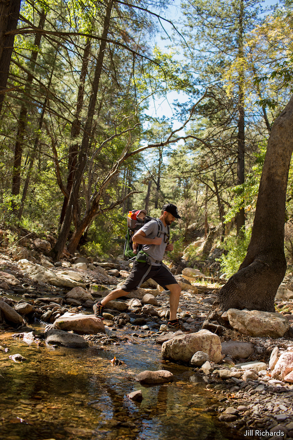
October is the perfect time to explore Arizona’s unique landscapes. Both experienced and beginning hikers will find beautiful hidden gems as they walk through hiking trails filled with wild flowers, diverse cactus and historic caves.
Debbie Johnson, the director of the Arizona Office of Tourism, says, “I moved here from Wyoming precisely because I fell in love with Arizona's sunny winters and autumns. I love being able to go hiking year-round, even in December or January. And this time of year, when summer breaks and the mornings cool off, is when I start thinking about all the new trails I want to try."
Superstition Wilderness
Situated 50 miles east of Phoenix, Superstition Mountain offers many miles of hiking on designated trails. It is home to impressive rock walks, jagged hoodoos of rock and narrow twisting canyons. Superstition Mountain is located in a true desert area, and it features several hiking trails including Peralta Trail, Miner’s Needle Loop and Flatiron. The first two trails are of moderate level, whereas Flatiron is more strenuous.
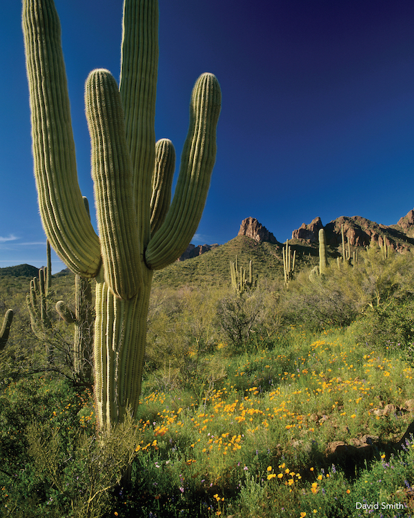
Saguaro National Park
Tucson is home to the nation’s largest cacti. The giant saguaro is the universal symbol of the American West, and most of these majestic plants are protected by Saguaro National Park. Whether you are looking for a short nature trail, or a day-long wilderness track, Saguaro’s trails got you covered with a variety of hiking trails for all levels of experience. One of Saguaro’s most beautiful trails is Freeman Homestead Trail, a 1.1-mile lightly trafficked loop trail near Tucson, for hikers of all levels.
Kartchner Caverns State Park
Kartchner boosts the world’s longest stalactite formation and introduces visitors to the mysterious world of caves. Kartchner Caverns is a massive limestone cave that’s home to remarkable minerals and formations as well as winged friends. Located in Southern Arizona, hikers can enjoy a 4.2-mile trail, the Guindani trail, that features semi-desert grassland at the lower elevations and open oak-juniper woodland on the higher slopes.
Organ Pipe Cactus National Monument
Organ Pipe Cactus Monument is an international Biosphere Reserve that hides a thriving community of plants and animals. Hikers will enjoy a scenic drive and have the option to go on strenuous or moderate trails. One of the park’s five main paths is Victoria Mine, a center for sporadic gold and silver excavations in the late 19th and early 20th centuries. The trail traverses gently sloping land while staying level overall and passes hillsides covered by numerous common types of cactus found in the area, including saguaro, organ pipe, cholla, opuntia and more.
Cave Creek Canyon (east side of Chiricahuas)
Located on the east side of the Chiricahua Mountains of Southeastern Arizona, Cave Creek Canyon is considered by many to be the crown jewel of this magnificent mountain range. It is the largest and most biologically diverse canyon in the Chiricahua Mountains and a favorite haunt of bird watchers and nature lovers. Experienced hikers can reach Silver Peak trail, a hidden gem of a mountain and a 9-mile moderately trafficked trail that features beautiful wild flowers.
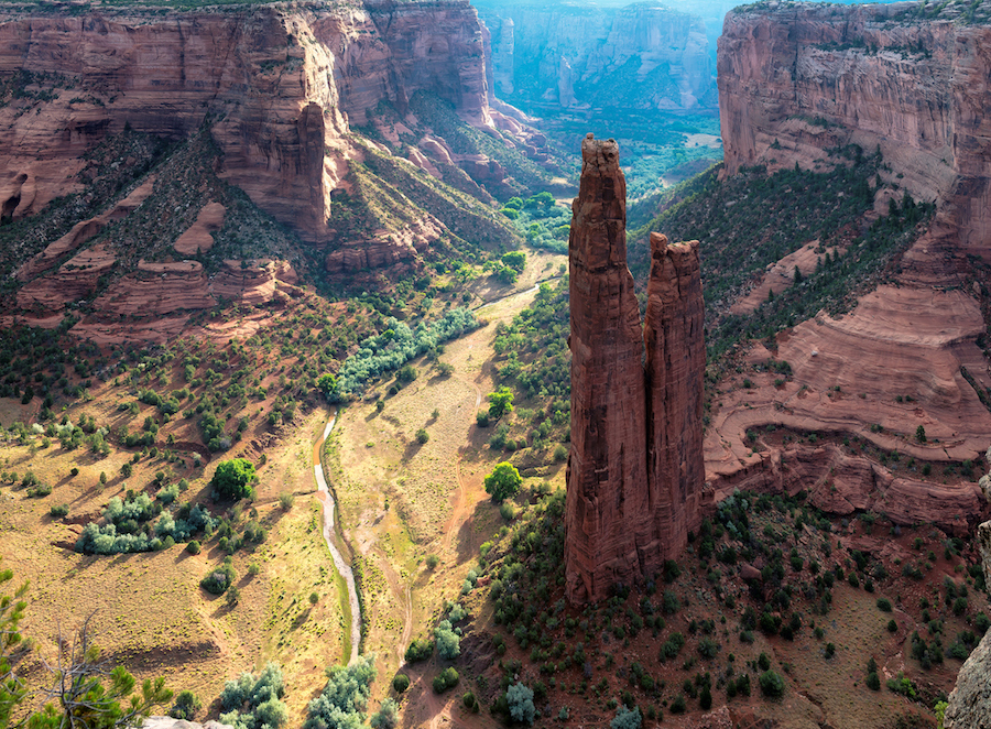
Canyon de Chelly
A one-of-a-kind landscape and the cherished homeland of the Navajo people. Arizona’s Canyon de Chelly Monument is located on Navajo land and offers a rich history with countless options for outdoor recreation. A self-guided hiking trail is located at the White House Overlook on the South Rim. The 600-foot round-trip hike usually takes about two hours, leading down to the White House Ruin and back.
Chiricahua National Monument
Chiricahua National Monument is a real wonderland of rocks. A visit to the park offers a range of activities and attractions. From day hiking to wildlife viewing and nature photography, the park’s mild climate is suitable for a wide variety of outdoor activities throughout most of the year. For a short hike and an opportunity to walk among the rock formations, explore Echo Canyon trail, whereas Inspiration Point will take you on a strenuous three to eight-hour hike with elevation changes of 500 to 1,000 feet.