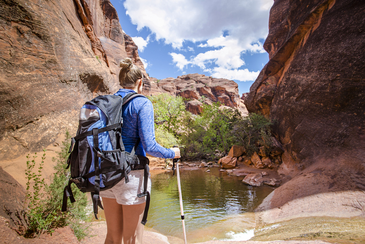
After an unusually rainy winter (the sixth-wettest on record in the Phoenix area), it’s a great time to get out and go hiking. Wildflowers are in bloom and temperatures are still mild. So lace up your boots, grab a hat and sunscreen, and get ready for a weekend adventure at any of these six trails in the Phoenix area.
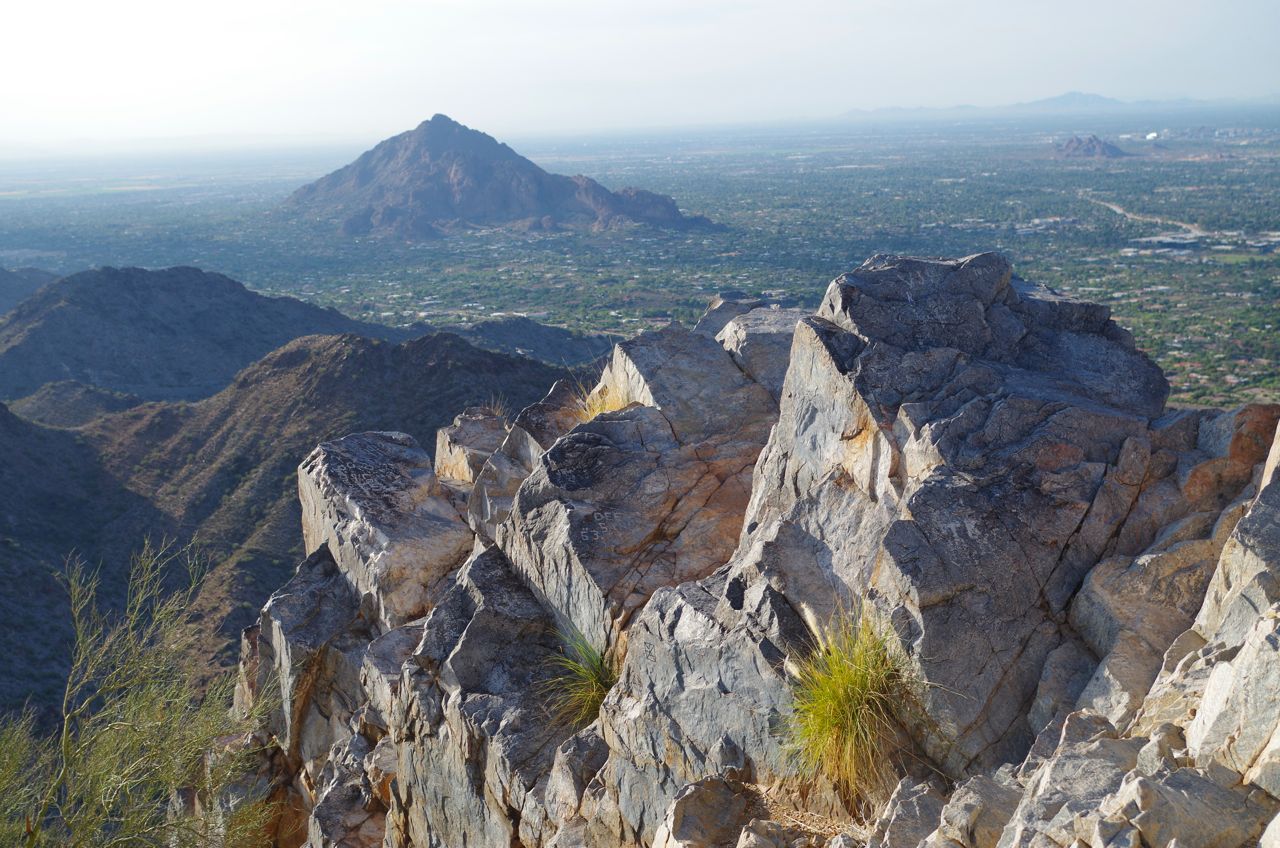
Piestewa Peak Summit Trail
Location: Phoenix Mountain Preserve
Length: 1.2 miles
Difficulty: Moderate/Difficult
The Piestewa Peak trail is a long-time Phoenix favorite (locals call it Squaw Peak). It offers spectacular 360-degree views of the city and surrounding mountains. The hike to the peak and back isn’t long, but it can be challenging with a lot of switchbacks, stone steps, and jagged, steep areas. It’s usually crowded because it’s so close to town, and parking can be tough during peak hours (mornings and evenings).
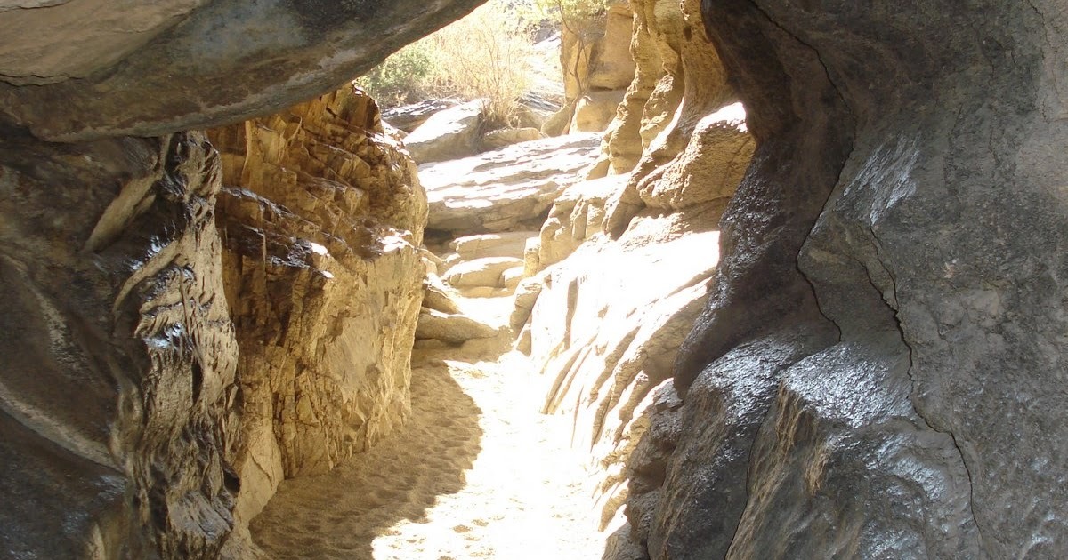
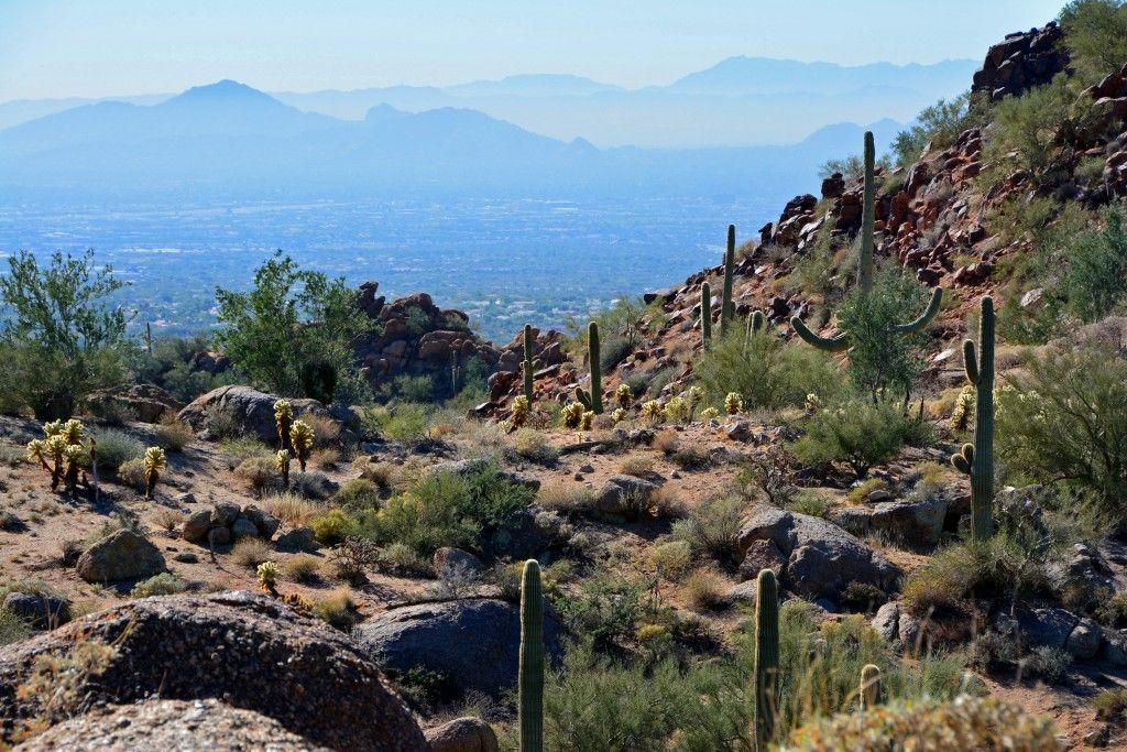
Hidden Valley via Mormon Trail
Location: South Mountain Park/Preserve
Length: 3.4 miles
Difficulty: Moderate
This family-friendly trail features a narrow rock passageway (Fat Man’s Pass), a stone tunnel and petroglyphs, along with stunning views of Phoenix and nearby peaks. A bonus feature: Silent Sundays. The roads in the park are closed to motorized vehicles the fourth Sunday of every month through the end of March. Starting at the Mormon Trailhead, take the Mormon Trail to National Trail, then proceed to Hidden Valley Trail.
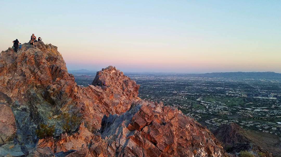
Camelback Mountain
Location: Camelback Mountain Echo Canyon Recreation Area
Length: 1.5 miles (Cholla), 1.2 miles (Echo Canyon)
Difficulty: Extremely Difficult
Enthusiasts call this “the” hike in Phoenix. It gets its name because the mountain’s two peaks which resemble the head and hump of a sleeping camel. Be warned: both trails are extremely challenging and not for beginners, and it's usually crowded. Echo Canyon Trail is steeper but quicker. Cholla Trail is longer and not as steep, but it’s still tough and requires a tricky scramble over large boulders near the top. That said, the views at the top are worth the effort, and it’s easy to see why so many people brave the climb.
Tom’s Thumb
Location: McDowell Sonoran Preserve (Scottsdale)
Length: 4.2 miles
Difficulty: Moderate/Difficult
Another iconic and popular hike near Phoenix, Tom’s Thumb features impressive rock formations, great views and an amazing array of wildflowers. There are restrooms and sunshades at the trailhead, but no water so you’ll need to bring your own (as always, bring plenty!) Tom’s Thumb, the trail’s namesake, is impossible to miss. The huge granite lump serves as the trail’s turn-around point. McDowell Sonoran Preserve, where Tom’s Thumb is located, is a fantastic place to camp whether it be in an RV rental or a tent.
Pinnacle Peak Trail
Location: Pinnacle Peak Park (Scottsdale)
Length: 3.5 miles
Difficulty: Moderate
If you’re interested in exploring Sonoran desert scenery without wandering far off the beaten path, this hike is for you. The smooth out-and-back trail is challenging enough for a good workout, but it’s easy enough for kids to enjoy. You’ll see giant saguaros and plenty of other desert flora and fauna, and the views are stunning. The trailhead has parking, restrooms and water. Don’t let the “I’m hiking in a neighborhood” feel at the start fool you: it doesn’t take long for this to become a fun escape.
Siphon Draw Trail
Location: Lost Dutchman State Park
Length: 4 miles
Difficulty: Moderate
This is a scenic but demanding hike in the Superstition Mountains about 40 miles east of Phoenix. It’s another chance to see this spring’s incredible explosion of native plants and wildflowers. While you can’t pick the poppies or parry’s penstemon in the park, you can take a selfie with them. This hike also provides a great view of the rock formation known as the Flatiron. You can hike up the Flatiron, but that’s recommended for experienced (and fit) hikers willing to do some rock climbing. If you’re considering that part of the hike, do your research, dress appropriately and download a map because the trail isn’t well marked toward the top.
Dogs are allowed on several of these hikes (Hidden Valley via Mormon Trail, Tom’s Thumb and Siphon Draw Trail). Keep in mind, Phoenix’s leash law applies while you’re on the trail. It’s actually for Fido’s safety as well as for fellow hikers. Rattlesnakes are coming out of hibernation right now, and you don’t want your four-legged friend chasing after them. The snakes are just as afraid of us as we are of them so they tend to hide in tall grasses and shrubs. (Another reason not to pick wildflowers!) Stick to the trails and take a lot of pictures and you’ll have bragging rights when you summit each peak.
Nannette Walker is a gardening and design writer for WikiLawn Phoenix, and has a true passion for growing her own food. She enjoys camping, hiking, and most other outdoor adventure activities.